This function sets the map projection. It can also be set via tm_shape(), but tm_crs is generally recommended for most cases. It can also be determined automatically (see details); however, this is still work-in-progress.
Arguments
- crs
Map projection (CRS). Can be set to an
crsobject (seesf::st_crs()), a proj4string, an EPSG number, the value"auto"(automatic crs recommendation), or one the the following generic projections:c("laea", "aeqd", "utm", "pconic", "eqdc", "stere"). See details.- property
Which property should the projection have? One of:
"global","area"(equal-area),"distance"(equidistant),"shape"(conformal). Only applicable ifcrs = "auto". See details.- bbox
bounding box. Three options: a
sf::st_bbox()object, an Open Street Map query (passed on totmaptools::geocode_OSM()), or"FULL", which means the whole earth , which means the whole earth (this also guarantees that transformations to another CRS keep the whole earth, unlikesf::st_bbox()).- ...
passed on to
bb(e.g.extcan be used to enlarge or shrink a bounding box)
Details
The map projection (crs) determines in which coordinate system the spatial object is processed and plotted.
See vignette: Map projections (CRS). The crs can be specified in two places: 1) tm_shape() and tm_crs().
In both cases, the map is plotted into the specified crs. The difference is that in the first option, the crs is also taken into account in spatial transformation functions, such as the calculation of centroids and cartograms. In the second option, the crs is only used in the plotting phase.
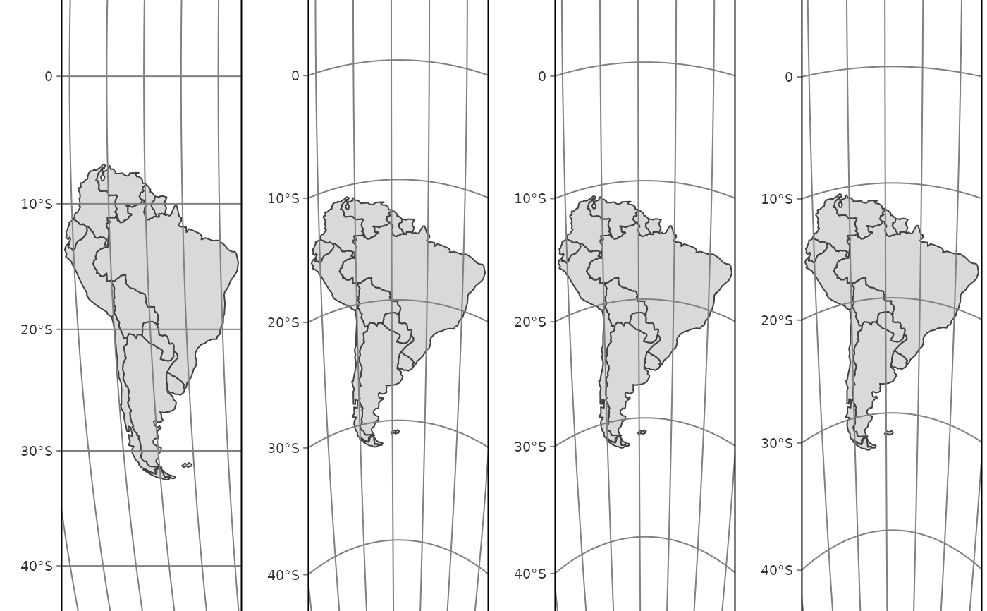
The automatic crs recommendation (which is still work-in-progress) is the following:
| Property | Recommendation |
global (for world maps) | A pseudocylindrical projection tmap option crs_global, by default "eqearth (Equal Earth). See vignette: Map projections (CRS) for more options |
area (equal area) | Lambert Azimuthal Equal Area (laea) |
distance (equidistant) | Azimuthal Equidistant (aeqd) |
shape (conformal) | Stereographic (stere) |
For further info about the available "generic" projects see: for utm: https://proj.org/en/9.4/operations/projections/utm.html for laea: https://proj.org/en/9.4/operations/projections/laea.html for aeqd: https://proj.org/en/9.4/operations/projections/aeqd.html for pconic: https://proj.org/en/9.4/operations/projections/pconic.html for eqdc: https://proj.org/en/9.4/operations/projections/eqdc.html
Note
Plans are to migrate the functionality regarding generic crs and automatic crs recommendation to a separate package.
Examples
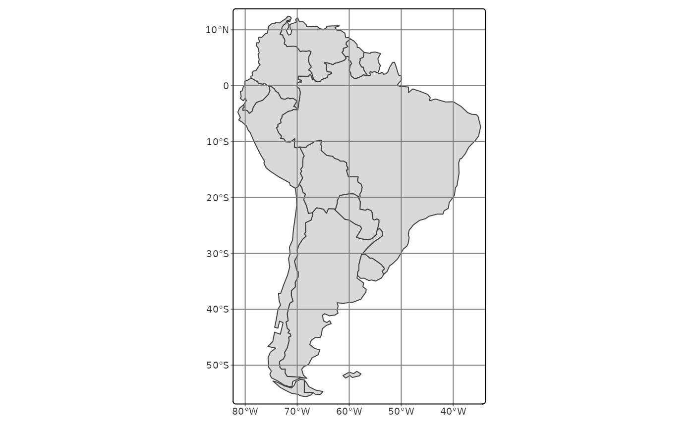
SA = World[World$continent == "South America", ]

# latlon coordinates (WGS84)
tm_shape(SA) +
  tm_polygons() +
  tm_graticules() +
  tm_crs(4326)


tm_list = lapply(c("global", "area", "distance", "shape"), FUN = function(property) {
  tm_shape(SA) +
    tm_polygons() +
    tm_graticules() +
    tm_crs(property = property)  +
  tm_title(property)
})

tmap_arrange(tm_list, nrow = 1)
tm_list = lapply(c("global", "area", "distance", "shape"), FUN = function(property) {
tm_shape(SA) +
tm_polygons() +
tm_graticules() +
tm_crs(property = property) +
tm_title(property)
})
tmap_arrange(tm_list, nrow = 1)