Basemaps
By default, basemaps are only shown in "view" mode, so
not in "plot" mode. Basemaps can be enabled or disabled via
tm_basemap().
Plot mode
To enable a basemap in plot mode, the package maptiles
is required. When specified without arguments, the default basemap is
“Esri.WorldGrayCanvas”. This can be changed,
e.g. "OpenTopoMap".
tm_shape(metro) +
tm_bubbles(size = "pop2020") +
tm_basemap("OpenTopoMap")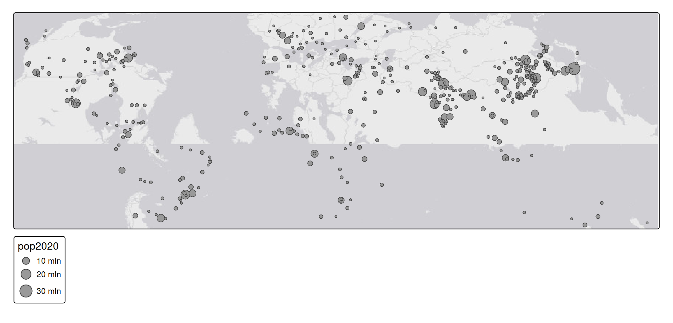
The options are:
Show
#> [1] "OpenStreetMap" "OpenStreetMap.DE"
#> [3] "OpenStreetMap.France" "OpenStreetMap.HOT"
#> [5] "OpenTopoMap" "Stadia.AlidadeSmooth"
#> [7] "Stadia.AlidadeSmoothDark" "Stadia.OSMBright"
#> [9] "Stadia.Outdoors" "Stadia.StamenToner"
#> [11] "Stadia.StamenTonerBackground" "Stadia.StamenTonerLines"
#> [13] "Stadia.StamenTonerLabels" "Stadia.StamenTonerLite"
#> [15] "Stadia.StamenWatercolor" "Stadia.StamenTerrain"
#> [17] "Stadia.StamenTerrainBackground" "Stadia.StamenTerrainLabels"
#> [19] "Esri.WorldStreetMap" "Esri.WorldTopoMap"
#> [21] "Esri.WorldImagery" "Esri.WorldTerrain"
#> [23] "Esri.WorldShadedRelief" "Esri.OceanBasemap"
#> [25] "Esri.NatGeoWorldMap" "Esri.WorldGrayCanvas"
#> [27] "CartoDB.Positron" "CartoDB.PositronNoLabels"
#> [29] "CartoDB.PositronOnlyLabels" "CartoDB.DarkMatter"
#> [31] "CartoDB.DarkMatterNoLabels" "CartoDB.DarkMatterOnlyLabels"
#> [33] "CartoDB.Voyager" "CartoDB.VoyagerNoLabels"
#> [35] "CartoDB.VoyagerOnlyLabels" "Thunderforest.OpenCycleMap"
#> [37] "Thunderforest.Transport" "Thunderforest.TransportDark"
#> [39] "Thunderforest.SpinalMap" "Thunderforest.Landscape"
#> [41] "Thunderforest.Outdoors" "Thunderforest.Pioneer"
#> [43] "Thunderforest.MobileAtlas" "Thunderforest.Neighbourhood"Tip: .tmap_providers contains the same information, but
stored as an environment, which is convenient with auto-completion
(e.g. RStudio); type .tmap_providers$ and the list of
options will appear.
Note: for Thunderforest and Stadia, a (free for personal use) API key is required.
See previews
tm_shape(metro) +
tm_bubbles(size = "pop2020") +
tm_basemap("CartoDB.PositronNoLabels")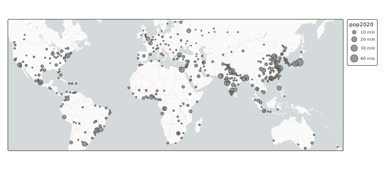
View mode
In view mode, there are even more options. These can be obtained via
names(leaflet::providers).
tmap_mode("view")
#> ℹ tmap modes "plot" - "view"
#> ℹ toggle with `tmap::ttm()`
tm_shape(metro) +
tm_bubbles(size = "pop2020") +
tm_basemap("Esri.OceanBasemap")Disabling basemaps:
tmap_mode("view")
#> ℹ tmap modes "plot" - "view"
tm_shape(World) +
tm_polygons(
fill = "grey80",
col = "grey60") +
tm_shape(metro) +
tm_bubbles(size = "pop2020") +
tm_basemap(NULL)
#> [tip] Consider a suitable map projection, e.g. by adding `+ tm_crs("auto")`.
#> [view mode] WebGL does not work (yet) with projected map projections, so it has
#> been disabled.
#> This message is displayed once per session.Now it is also possible to use different map projections (see vignette):
tmap_mode("view")
#> ℹ tmap modes "plot" - "view"
tm_shape(World, crs = "+proj=robin") +
tm_polygons(
fill = "grey80",
col = "grey60") +
tm_shape(metro) +
tm_bubbles(size = "pop2020") +
tm_basemap(NULL)